Nyungar Placenames in the South-West of Western Australia
| Home | Interactive Map | Search Placenames | About the Project | Contact | Information & Resources | News & Events |
| Aims And Background |
| Significance & Innovation |
| Approach & Methodology |
| National Benefit |
| Communication of Results |
| Role of Personnel |
| Role of Administering Organisation |
| School of Indigenous Studies UWA |
| References |
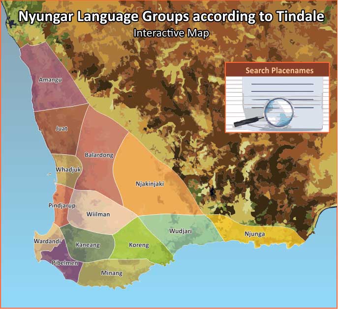
Maps of the Aboriginal groups of the South-West usually present placenames of the different Nyungar language groups. This mapping is mostly associated with the work of anthropologist, Norman Tindale.
The map of the South-West used for this project is based on information from Norman Tindale's 1974 attempt to depict Aboriginal tribal distribution at the time of European contact. 1
To explore any of the map regions, simply click on the shaded area. An enlarged map will appear, detailing the Nyungar placenames of the region. Further clicking will provide information about each placename shown.
For information on a particular placename, the “Search Placenames” panel allows for a search by name and provides an alphabetical list of all the placenames featured on this website.
(Please note, this map is contested and controversial.)